|
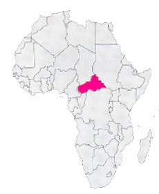
Location: Africa
Capital: Bangui (560.000 inhab.)
Main Cities: Berbérati, Bouar
Population: 3,615,000
Area: 622,436 km2
Coin: 1 CFA franc = 100 centimes
Languages: French
Religions: Animist, Roman Catholic, Protestant, Moslem
The Independence's Year: 1960
Mountains: Monts Bongos (1400 m.) e Monts Gaouraa (1275 m.)
Rivers: Oubangui
|
 |
|
As the name says it is a state located almost to the center of the Africa, without way outs on the sea, with damp hot climate and two completely dry seasons.
The territory is constituted from a wide plateau, that reaches 1.400 meters (Monts Bongos).
It is a poor state, poorly inhabited, with a density of about 3 inahb/kmq; submitted during the years to disastrous dictatorships (on all that of Bokassa in the years 1960-'70, that he crowned emperor with big pomp) and from power wars that produced dead and poverty.
Nevertheless the subsoil is rich of diamonds, golden, uranium and iron!
| * Information and news of every kind (and photographic documentation) about Central African Republic are to disposition of the partners of the Worldwide Geographic Academy: info@accademiageograficamondiale.com |
PHOTOGRAPHIC DOCUMENTATION UNDER CONSTRUCTION |
|


