|
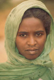
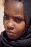
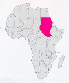
Location: Africa
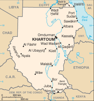
Capital: Khartoum (930.000 inhab.)
Main Cities: Port Sudan, Omdurman, Khartoum North, Wad Medani, Kassala, Nyala
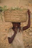
Population: 29,500,000
Area: 2,503,890 km2
Coin: 1 Sudanese dinar = 10 piastres
Languages: Arab
Religions: Moslem, Christian, Animist
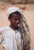
The Independence's Year: 1956
Mountains: Gebel Marra (3088 m.), Gebel Odda (2259 m.), Mt.Kinyeti (3187 m.)
Rivers: White Nile, Blue Nile |
 |
|
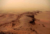
It is a very big nation (with 2 millions and half of Kmq is the widest country of the African continent), desert to North and marshy to South, everywhere very hot, with dry climate to North and damp to South.
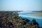
It is crossed from Nile for thousands of kilometers, from the border with Uganda in the extreme South up to border with Egypt to nord. Khartoum (the capital) is located to the confluence between the White Nile, that comes from the Victory Lake, and the Blue Nile that arrives from the plateaux of Ethiopia.
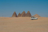
To North the nation is very pleasant, with the desert of Bayuda contained between the bends of Nile; with the very beautiful, little pyramids of Meroe and Napata, which raise from the yellow sands of the desert; with the Jebel Barkal (the holy mountain) that dominates the sinuous course of the big river, hemmed by a green strip of palms that cuts the desert in two.
| * Information and news of every kind (and photographic documentation) about Sudan are to disposition of the partners of the Worldwide Geographic Academy: info@accademiageograficamondiale.com |
|
|


.jpg)